With more than 800 miles of trails, the Great Smoky Mountains National Park is truly a hiker’s paradise. Approximately 40 percent of the Park lies within Swain County, making many of its trails easily accessible from Bryson City. Whether you’re seeking a leisurely walk or a challenging hike, the Park offers a variety of trails to explore.
One of the most popular areas for hiking is the Deep Creek area, located just two miles north of Bryson City. Here, you’ll discover a variety of trails that meander through lush forests, past cascading waterfalls, and along picturesque streams. The Deep Creek Loop, for example, is a favorite among visitors for its scenic beauty and accessible terrain.
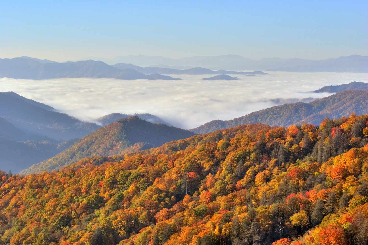
Another notable trailhead is located off Lakeview Drive, also known as the “Road to Nowhere,” which is six miles north of Bryson City. This area features several trails that lead to breathtaking views and serene natural settings, perfect for those looking to escape into the tranquility of the wilderness.
To enhance your visit to the Great Smoky Mountains National Park, please note that new parking regulations are in place:
These measures are designed to ensure a smooth and enjoyable experience for all visitors. Remember to plan ahead and acquire the necessary parking tags before embarking on your hiking adventure.
Check out our “Think Outside the Gym” 2-day vacation itinerary that includes jogging in Deep Creek.
The Great Smoky Mountains National Park offers a variety of trails for hikers of all skill levels. Below are some of the trails that provide stunning views and unique experiences.
– **Distance**: 4 miles
– **Difficulty**: Easy to Moderate
– **Description**: The trail is fairly level except for a one-mile section that crosses the 420-foot Sunkota Ridge (Loop Trail section). The trail passes by two beautiful waterfalls – Toms Branch Falls and Indian Creek Falls.
– **Distance**: Approximately 12 miles
– **Elevation Gain**: 350 feet
– **Difficulty**: Easy to Moderate
– **Description**: This loop offers a peaceful trek through varied terrain, making it a favorite for those seeking tranquility and nature.
– **Distance**: 14.2 miles
– **Difficulty**: Easy to Strenuous
– **Description**: Typically a one-way hike, requiring a second vehicle at the end of the trail. Many choose to walk this trail “down” from Newfound Gap Road.
– **Distance**: 6.7 miles (in and out)
– **Difficulty**: Strenuous
– **Description**: This trail offers spectacular views, with an elevation gain of 2300 feet in the first three miles. At the crest of Beauregard Ridge, the trail narrows to a razorback with breathtaking views of Bryson City, the Tuckasegee Valley, and the Nantahala Mountains.
– **Distance**: 11.2 miles one way
– **Description**: A continuation for the more adventurous, this trail connects Deep Creek with Kuwohi Road.
– **Distance**: 6 miles (in and out)
– **Difficulty**: Easy
– **Description**: Starting from a parking lot near the end of the Road to Nowhere, this trail follows an old service road with a gentle grade. Near the three-mile mark, remnants of an old farm can be seen.
– **Distance**: 3 miles
– **Description**: Accessible through the tunnel at the end of the ‘Road to Nowhere’, this trail offers a short but scenic loop.
– **Distance**: 42 miles
– **Description**: This extensive trail crosses Forney Creek, Hazel Creek, and Eagle Creek on its way to Fontana Dam, offering a challenging yet rewarding experience for seasoned hikers.
These trails are ideal for anyone looking to explore the natural beauty of the Great Smoky Mountains. Whether you’re seeking a leisurely walk or a challenging hike, these trails offer something for everyone.
‘A Walk in the Woods’ — the book and movie have stirred increased interest in the Appalachian Trail. The Bryson City area has six segments of the AT that are perfect for weekend hikers, plus another 40-mile, 3-4 day backpacking segment. More information.
The Appalachian Trail stretches through Swain County from south of the Nantahala Gorge; across Fontana Dam and then follows the highest ridges of the Great Smoky Mountains National Park past Kuwohi (formerly Clingmans Dome) and Newfound Gap on its way to Maine. You can access the trail at Wesser in the Nantahala Gorge, Fontana Dam, Newfound Gap, and at Kuwohi.
A popular section of the AT is from Newfound Gap to Charlie’s Bunion. The 8-mile-round-trip hike passes through a spruce and fir forest with spectacular vistas. The hike as an elevation gain of 1640 feet and is considered strenuous.
Kuwohi to Andrews Bald is a moderate 3.5 mile hike (in and out) with an elevation gain of 899 feet. Popular for its spectacular views, Andrews Bald is accessed via the Forney Ridge Trail, which is located at the far end of the Kuwohi parking lot.
Kephart Prong Trail — 4.2 miles in and out, the trailhead is on Newfound Gap Road (US 441) about 7 miles north of the Oconaluftee Visitor Center. With an elevation gain of 955 feet, the trail is considered moderate. In the first quarter mile, you’ll see remnants of the depression era Civilian Conservation Corps (CCC) camp. Most hikers turn around at mile 2.1 at the Kephart camping shelter.
Mingus Creek Trail — An in and out hike, 6 miles in length; easy to moderate with an elevation gain of 1515 feet. Trail begins at the Mingus Mill parking lot just north of the Oconaluftee Visitor Center. The lower two miles include Mingus Mill, remnants of CCC camp #4484, and if you take the right fork at Mile 1.25, an old road to a historic cemetery.
Self-Guided Nature Trails — The National Park has several self-guided nature trails in Swain County: The half-mile Spruce-Fir walk begins on Kuwohi Road and introduces you to the conifer forests that grow only on the high peaks this far south in the eastern U.S. Smokemont — the 0.75 mile walk begins at Smokemont Campground and shows examples of human impact on the land, such as logging and farming. Balsam Mountain — the 0.75 mile walk begins at Balsam Mountain Campground and shows how nature has reclaimed a once-logged northern hardwood forest.
While dogs are not permitted on the Deep Creek trails, there are several pet-friendly alternatives that allow you and your furry friend to enjoy the beauty of the Great Smoky Mountains National Park and its surrounding areas.
1. **Oconaluftee River Trail**
This is one of two walking paths in the National Park where visitors can walk dogs and bicycle (the other is the Gatlinburg trail). Pets and bicycles are prohibited on all other park trails. The trail travels 1.5 miles one-way from the Oconaluftee Visitor Center’s Mountain Farm Museum to the outskirts of the city of Cherokee, NC. It is relatively flat, but does have a few small hills. The trail runs through the forest alongside the Oconaluftee River and offers beautiful views of the river.
2. **Island Park**
Located in downtown Bryson City, this park is accessible by taking Everett Street to Bryson Street. Cross the bridge over to the park at the end of Bryson Street. It’s a great spot for a leisurely walk with your pet.
3. **Recreation Park**
This park features a walking trail situated on West Deep Creek Road, just outside of downtown Bryson City. To get there, take Everett Street to Depot Street, then continue on West Deep Creek Road to the Park. It’s a convenient location for a quick outing with your dog.
4. **Nantahala National Forest**
Trails in the Nantahala National Forest are pet-friendly. One popular paved trail is the Nantahala River Bike Trail TR368. This flat trail begins at the rafting launch site (off Hwy 74, south of the NOC, turn left on Wayah Road). Park at the launch site and take the bridge across the river. The trail follows the river for about 1.5 miles, providing a pleasant walk.
5. **Tsali Multi-Use Trail System**
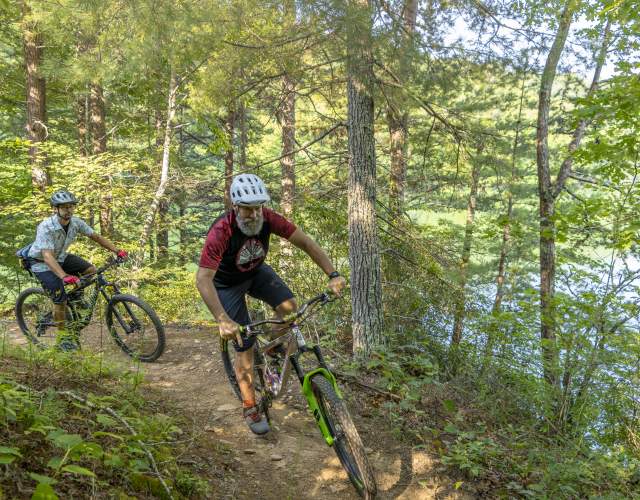
Famous among mountain bikers, the Tsali trail system is also dog-friendly. Located 15 miles west of Bryson City off Highway 28, this trail system allows for a variety of activities, including biking and horseback riding, making it a bustling hub for outdoor enthusiasts.
These trails offer diverse experiences ranging from serene river views to bustling multi-use paths, ensuring both you and your pet can enjoy the natural beauty of the area.
Our Smoky Mountain guides make A Walk in the Woods the best in the region. Since 1998, we have always had the top guides in the business, known for their expertise in leave no trace ethics, botany, wildlife, geology, culture, and history of the Great Smoky Mountains. Our mission is raising environmental awareness through direct, fun, positive experiences with nature. Our wide range of offerings include easy and moderate hikes, overnight camping and backpacking trips, shuttle service, and more.
Come hike with us on one of our popular guided hikes like the Sunset Hike, Waterfalls, or even Overnight! At Carolina Bound Adventures, we specialize in individuals and families new to hiking that want to get out there but want a guided adventure and all equipment provided. We even offer a convenient Hiker Shuttle Service if you need a vehicle drop or hiker pick-up – now that’s service!
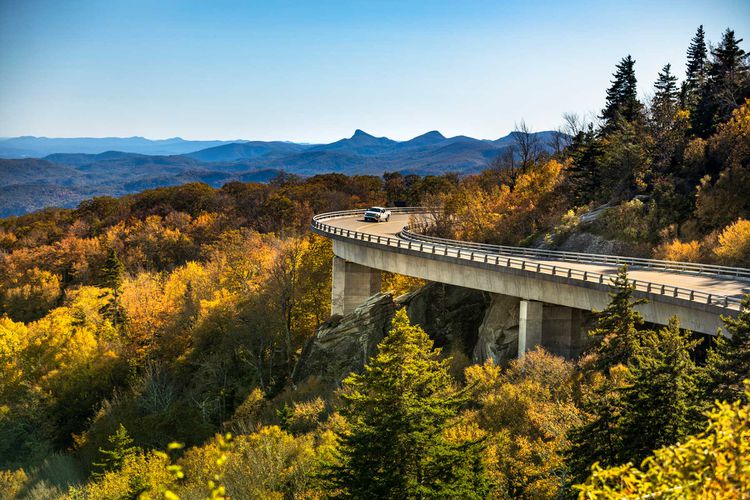
Quiet walks and hiking trails all along the Parkway. Local favorites are Waterrock Knob and Graveyard Fields.
Take a break from watching the Elk herds and enjoy one of several hikes to see historic structures.
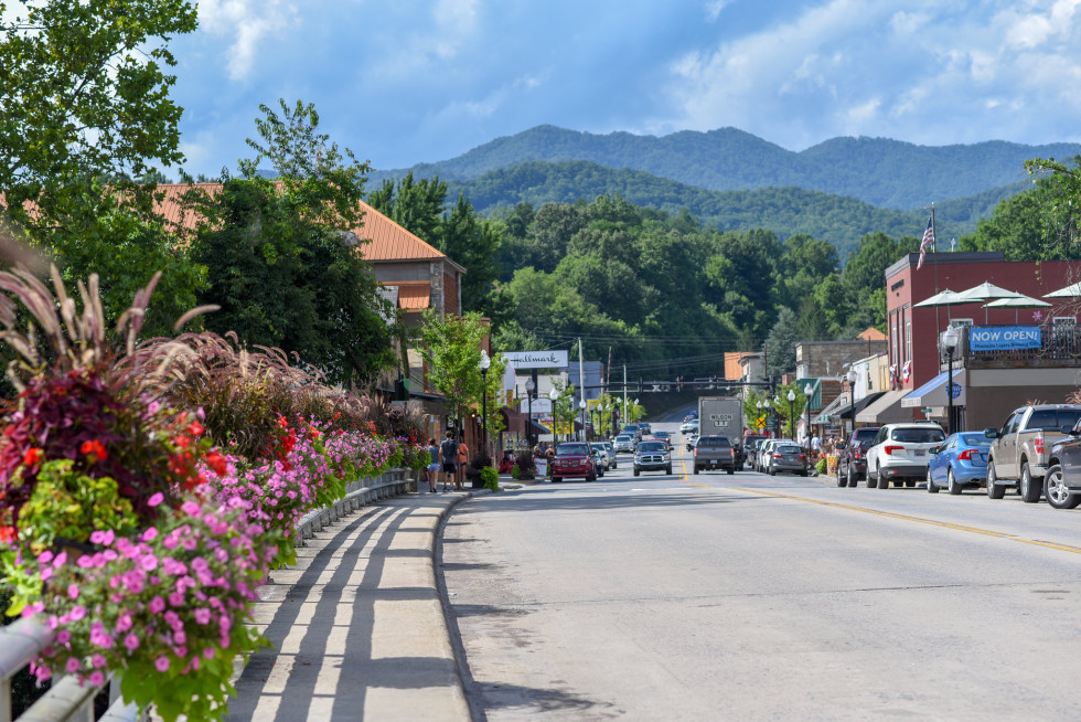
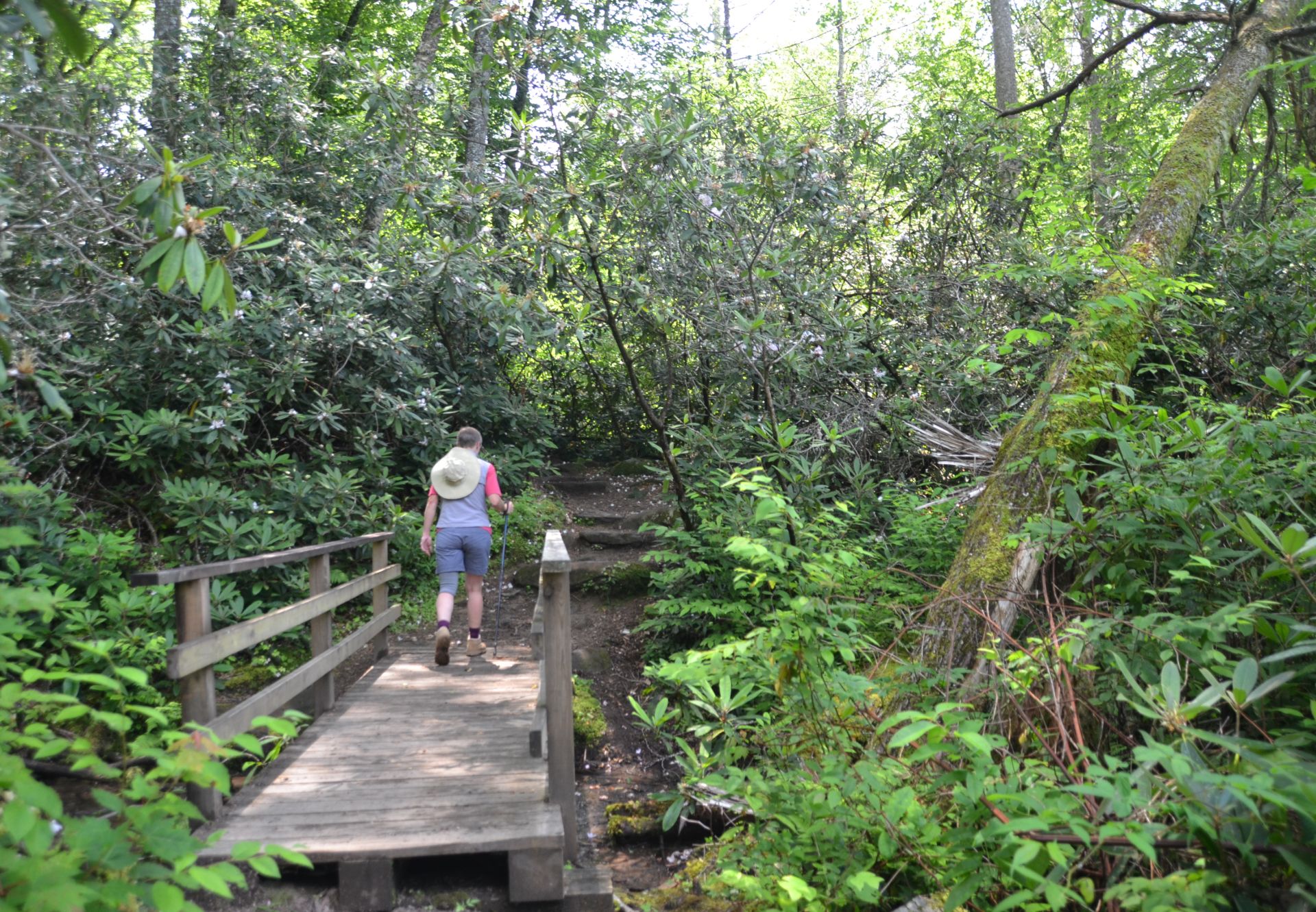
This magnificent 3800-acre forest is a remnant of an old-growth cove hardwood forest. Enormous yellow poplar, hemlock, basswood, beech, and other trees tower over the two loop trails. Twelve miles northwest of Robbinsville, NC, off Hwy 143.
Four singletrack trails that hikers share with mountain bikers and horseback riders (alternate days). Beautiful views of Fontana Lake from Left Loop.
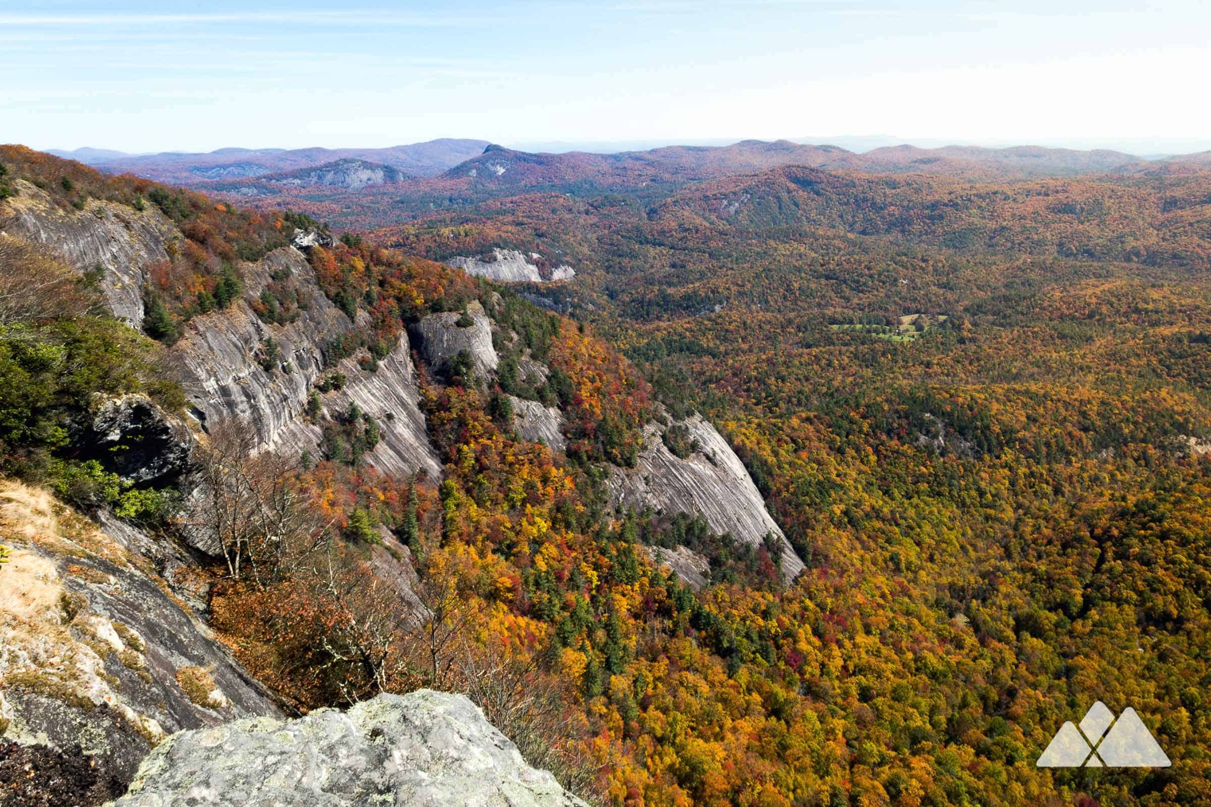
Named for its sheer white cliffs, Whiteside Mountain rises above the Nantahala National Forest near Highlands, NC. A two-mile loop trail leads to the 4,930-foot summit.